

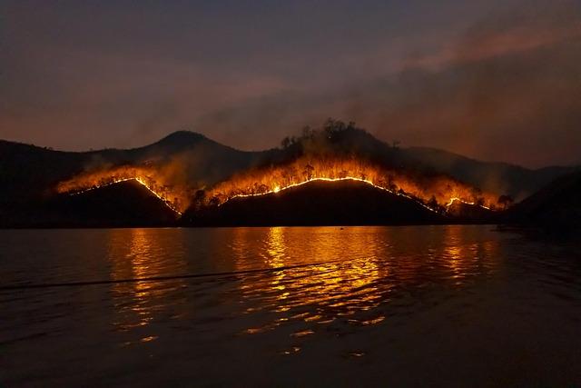
A rapidly evolving wildfire in Nebraska has captured the attention of authorities and residents alike. The Road 203 Fire, currently burning in the heart of the state, is being closely monitored through real-time updates on the IQAir Wildfire Map. This valuable tool offers critical insights into the fire’s progression, air quality impacts, and containment efforts, providing essential information for those affected and emergency responders on the ground. As the situation develops, continuous coverage aims to keep communities informed and safe amid the growing threat.
Wildfire Map Spotlight on Road 203 Fire Nebraska Overview and Current Status
The Road 203 Fire, burning across Nebraska’s rural landscapes, has rapidly escalated, prompting heightened responses from local authorities and emergency services. Spreading through dry grasslands and wooded areas, the blaze poses a significant threat to both wildlife habitats and nearby communities. Containment efforts are ongoing, but strong winds and dry conditions continue to challenge firefighters on the ground. Evacuations have been mandated in several zones as officials prioritize public safety and the protection of critical infrastructure.
Current data from IQAir’s wildfire map reveals vital insights into the fire’s trajectory and air quality impact. Key factors monitored include:
- Fire perimeter expansion — showing rapid growth in the northwest region.
- Airborne particulate levels — with PM2.5 concentrations climbing well above safety thresholds.
- Wind patterns — influencing the direction of smoke dispersion and firefighter access.
| Parameter | Current Status | Forecast |
|---|---|---|
| Fire Size | Approx. 12,500 acres | Potential 15% increase over 48 hrs |
| Air Quality (PM2.5) | Hazardous in affected zones | Gradual improvement expected with containment |
| Containment | 35% | Projected 60% by next update |
Environmental Impact and Air Quality Concerns Linked to the Road 203 Fire
The Road 203 Fire has significantly disrupted local ecosystems, causing severe consequences to Nebraska’s environmental health. The blaze has consumed thousands of acres of grassland and forest, leading to habitat destruction and a looming threat to native wildlife. The loss of vegetation not only diminishes biodiversity but also destabilizes soil, increasing vulnerability to erosion and reducing the land’s natural resilience to future environmental stresses.
Beyond ecological damage, air quality in nearby communities has deteriorated rapidly due to the smoke and particulate matter released by the fire. Elevated levels of fine particulate matter (PM2.5) and carbon monoxide have been detected, prompting public health warnings and air quality alerts. Key pollutants monitored in affected areas include:
- PM2.5: Fine particles that can penetrate deep into the lungs, causing respiratory issues.
- Carbon Monoxide (CO): A colorless gas that poses serious health risks at high concentrations.
- Volatile Organic Compounds (VOCs): Chemicals that contribute to ozone formation and respiratory irritation.
| Pollutant | Current Level | EPA Standard | Status |
|---|---|---|---|
| PM2.5 | 85 µg/m³ | 35 µg/m³ (24-hr avg) | Unhealthy |
| Carbon Monoxide | 12 ppm | 9 ppm (8-hr avg) | Hazardous |
| Ozone (VOCs) | 0.095 ppm | 0.070 ppm (8-hr avg) | Unhealthy for Sensitive Groups |
Emergency Response Efforts and Evacuation Updates for Affected Communities
Local authorities have mobilized swiftly to contain the impact of the Road 203 Fire, prioritizing the safety and wellbeing of residents in its path. Emergency response teams are coordinating closely with state and federal agencies to facilitate prompt evacuations and establish temporary shelters. Firefighters are also conducting controlled burns to create firebreaks, aiming to slow the wildfire’s spread and protect critical infrastructure. Residents in high-risk zones are urged to monitor official channels for real-time updates and to adhere strictly to evacuation orders.
- Mandatory evacuation zones have been expanded along the fire perimeter.
- Evacuation centers set up at community centers and schools in nearby towns.
- Road closures and traffic rerouting in effect for major access routes.
- Continuous air quality monitoring due to increased smoke and particulate levels.
| Evacuation Zone | Status | Nearest Shelter |
|---|---|---|
| Zone A (Immediate Threat) | Evacuated | Lincoln High School |
| Zone B (Caution) | Advised to Prepare | Crete Community Center |
| Zone C (Monitoring) | On Alert | Waverly Public Library |
Health Precautions and Safety Recommendations for Residents and Travelers
In light of the ongoing Road 203 Fire in Nebraska, it is critical for residents and travelers to stay vigilant and prioritize health safety. Due to deteriorating air quality, it is strongly advised to limit outdoor activities, particularly for vulnerable groups such as children, the elderly, and individuals with respiratory conditions. Wearing N95 respirators can significantly reduce inhalation of harmful particles when going outside, and utilizing indoor air purifiers can maintain safer indoor environments. Additionally, monitoring local air quality indexes through trusted sources will provide real-time updates crucial for making informed decisions.
Essential safety tips include:
- Keeping windows and doors closed to minimize smoke infiltration.
- Staying hydrated and using saline nasal sprays to alleviate throat and nasal irritation.
- Avoiding physical exertion outdoors to reduce respiratory strain.
- Seeking immediate medical attention if experiencing symptoms such as persistent cough, chest pain, or difficulty breathing.
| Recommended Precaution | Priority Group | Expected Benefit |
|---|---|---|
| N95 Mask Usage | All Residents & Travelers | Reduced particle inhalation |
| Indoor Air Purifiers | Households in Affected Zones | Cleaner indoor air |
| Limit Outdoor Time | Children & Elderly | Lower respiratory risk |
| Emergency Medical Consultation | Individuals with Symptoms | Timely health intervention |
Closing Remarks
As the Road 203 Fire continues to burn through Nebraska, real-time data from IQAir’s wildfire map remains a crucial resource for residents, firefighters, and authorities monitoring the evolving situation. Accurate and up-to-date information helps guide evacuation efforts, air quality warnings, and response strategies. Stakeholders are urged to stay informed through official channels and digital platforms as containment efforts progress. The Road 203 Fire serves as a stark reminder of the growing wildfire risks facing communities across the United States and the importance of advanced monitoring technologies in managing these fast-moving natural disasters.